The National Weather Service's 6 to 10-day outlook from November 23 to 27 indicates that most areas of the usa may experience temperatures near or above normal levels.
The following is the agriculture weather advisory for the usa on November 18, 2024, Monday, exclusively compiled by the Gold Ten Futures APP.
Western United States Cool and rainy weather extends from the northwestern Pacific to the northern Rockies. This rain is beneficial for crops in the northwest, including winter wheat and small grains sown in the spring. At the same time, the hot weather in the Southwest is beneficial for farming and crop growth, although there is a high wildfire threat in some areas of Arizona and New Mexico.
Scattered rain and snowfall have occurred in some areas, including the pacific northwest and northern inland mountainous regions. Despite the cool weather, fieldwork continues in the western regions, including cotton harvesting in arizona and california.
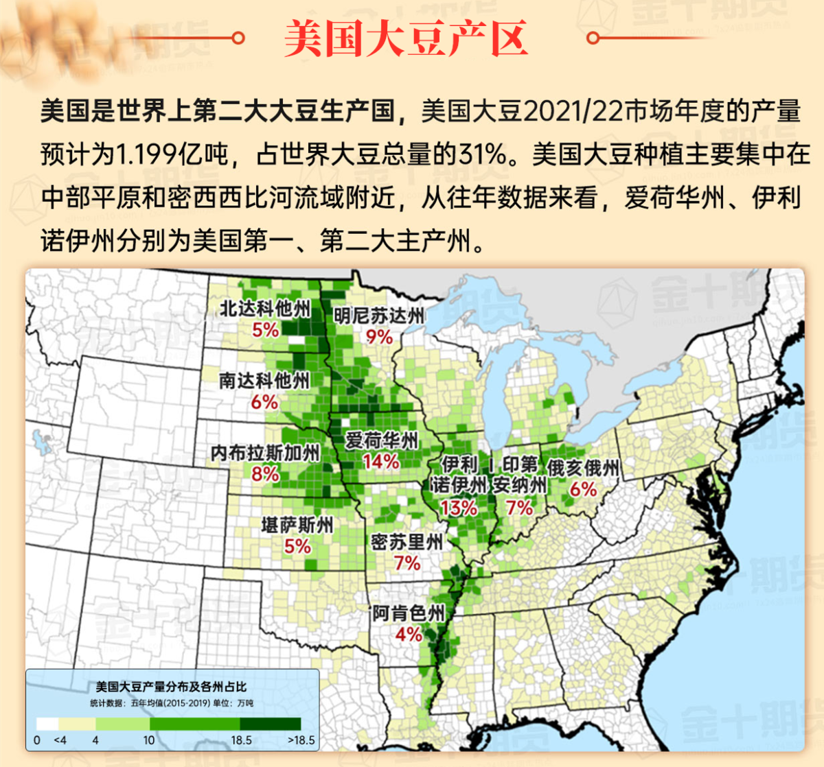
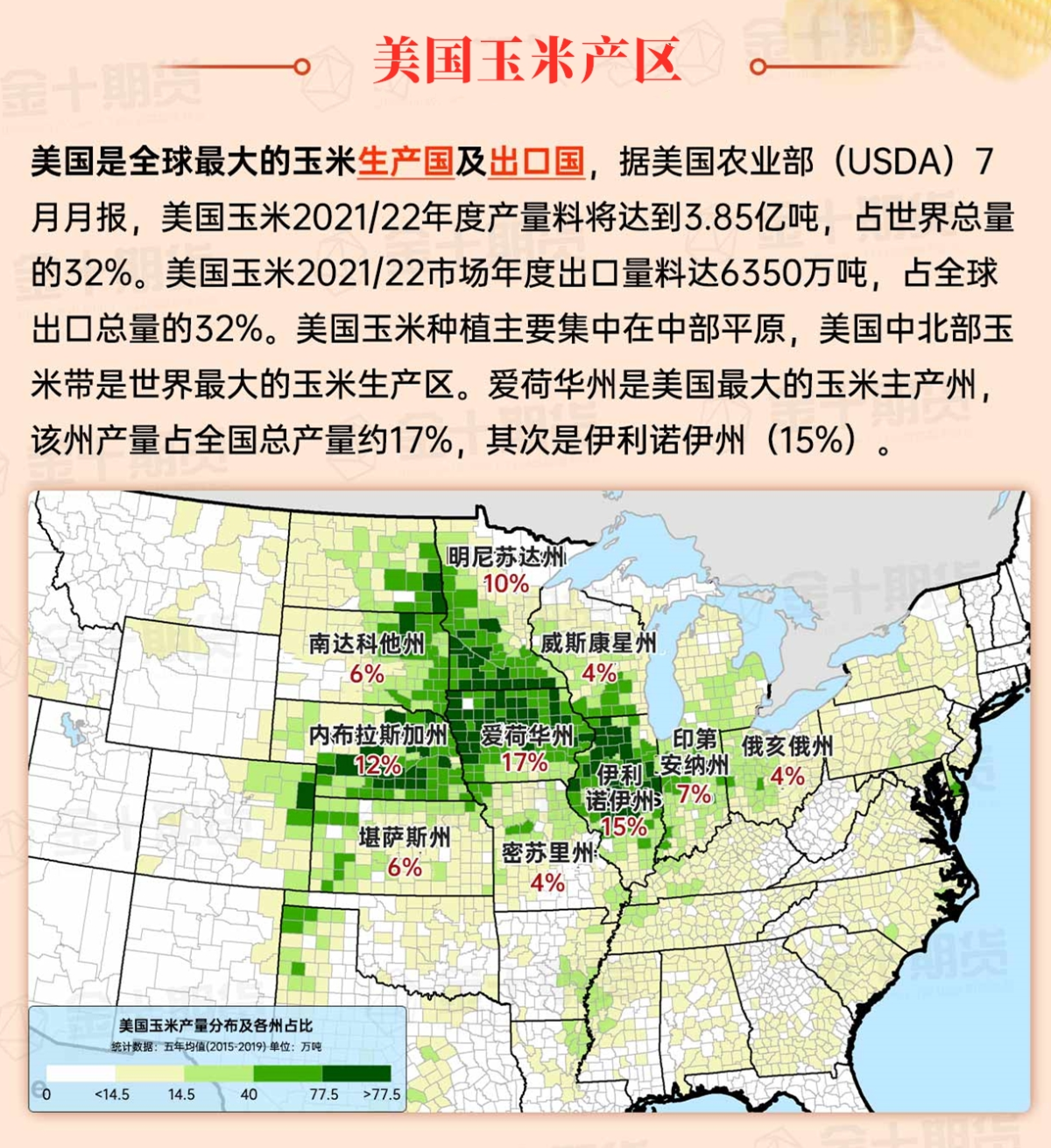
Corn Planting Area of the United States Showers and a few thunderstorms extend southwest from the Upper Midwest. At the same time, warm and mostly dry weather in the eastern corn belt is favorable for late-season corn and soybean planting, as well as winter wheat growth.
 Severe weather threats in the southern regions are moving eastward. The central and southern plains have also welcomed localized heavy rains, providing additional drought relief for recently planted winter chicago srw wheat. However, severe drought conditions persist in the northern plains. According to the latest usa drought monitoring report, 19%, 14%, and 11% of areas in north dakota, montana, and south dakota, respectively, are in extreme to exceptional drought (D3 to D4).
Weather Outlook Initially, the active weather in most parts of the United States will eventually consolidate along the cold front sweeping through the central United States on Tuesday. Subsequently, the cold front will reach the coastal states along the Atlantic Ocean on Thursday, although cool and unstable showers will persist in the Great Lakes states for a few days. According to preliminary reports, the United States will breathe a sigh of relief from the continuous thunderstorms that triggered more than 500 tornadoes in May. Before calm weather arrives, precipitation in the eastern half of the United States may reach 1 to 3 inches, except in the southern hinterland. In addition, early heat waves will expand in the western United States this weekend, with maximum temperatures exceeding 110 degrees Fahrenheit and covering lower altitude areas in the desert southwest.
Rain is diffusing into the mid-Mississippi River and downstream Missouri River areas. In other parts of the midwest, moderate dry weather is favorable for fieldwork, including late-season winter chicago srw wheat planting and the final harvest of corn and soybean.
Map of US Corn Production Areas
Warm and dry weather dominates, although rain is seeping in from the plains. Late-season fieldwork includes harvesting summer crops and planting winter wheat. In North Carolina, as of November 10, 49% of the planned winter wheat planting area has been completed. On the same day, 53% of soybean harvesting was completed in North Carolina, 60% of cotton was harvested, and 88% of peanuts were harvested.
Chicago SRW Wheat and Corn Futures
In the coming days, as cold air continues to cover the western region, a frost warning has been issued for the Central Valley of California for Tuesday morning. Meanwhile, the Santa Ana wind event in Southern California is expected to peak on Tuesday, accompanied by a higher threat of wildfire. In the farther east, localized heavy rain currently affecting the southern usa is expected to move north and east. With the interaction of the cold front and the tropical moisture associated with the now-dissipated tropical storm Sara, parts of the Gulf Coast may experience heavy rain (with localized rainfall amounts reaching 2 to 4 inches or more). Elsewhere, total precipitation over five days from the upper midwest to the northeast may reach 1 inch or more, with snowfall possible in North Dakota and surrounding areas, as well as in the higher elevations of the central and northern Appalachian mountains, by midweek. After rain and snowfall, temperatures later this week in parts of the northern plains may drop below 10°F.
The usa National Weather Service's 6 to 10-day outlook from November 23 to 27 predicts that temperatures across much of the country may be near or above normal levels, while the south atlantic region and the northern regions from Washington to North Dakota may remain below normal levels. At the same time, precipitation from the central and southern plains to the atlantic coast may be near or below normal levels, contrasting with the more normal and wetter weather from the lower Colorado River to the northern and northwestern areas above Lake Huron.
Soybeans should be translated as soybean.

The Atlantic Ocean should be translated as the Atlantic.

Cotton should be translated as cotton.


 南部地区的严重天气威胁正在向东移动。中部和南部平原地区也迎来了局部大雨,这为最近种植的冬小麦提供了额外的干旱缓解。然而,北部平原地区仍然存在严重的干旱问题。根据最新的美国干旱监测报告,北达科他州、蒙大拿州和南达科他州分别有19%、14%和11%的地区处于极度到异常干旱状态(D3至D4)。